Virtual Blönduós & Árnes
Browser-based Unity digital twins of two Icelandic towns, built at Envalys for public engagement in urban planning — I developed the viewers, their dynamic resource streaming, WebGPU R&D, and the cloud infrastructure behind them.
- Unity
- WebGL
- WebGPU
- C#
- DigitalOcean
- Urban Planning
My role
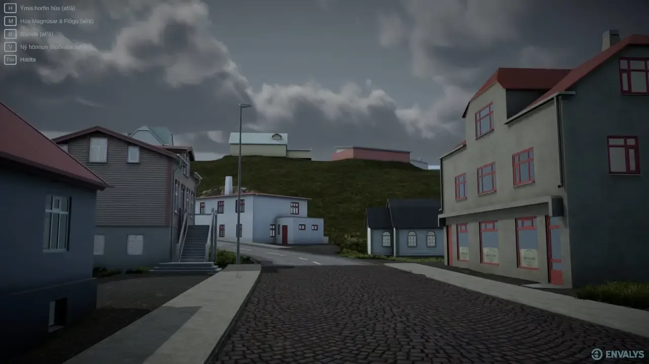
Software engineer at Envalys. I developed and optimized the virtual replicas of Blönduós and Árnes for the browser, implemented dynamic resource streaming for real-time urban modification visualization, conducted WebGPU R&D to move beyond WebGL's limits, and migrated the hosting infrastructure from AWS to DigitalOcean.
Outcome
Live, browser-accessible planning tools that let residents and stakeholders explore proposed developments in their own towns — no installation, no VR headset required.
When a municipality plans a new development, most residents first meet it as a zoning document and a top-down blueprint — abstractions that are hard to have an opinion about. Envalys builds the alternative: faithful, first-person 3D replicas of real Icelandic places where anyone can walk the streets of a proposed future and react to it before it gets built.
I joined Envalys as a software engineer in 2024 to build and run the virtual replicas of Blönduós and Árnes — two towns in rural Iceland whose residents and planners needed a common picture of what was coming.
The engineering problem
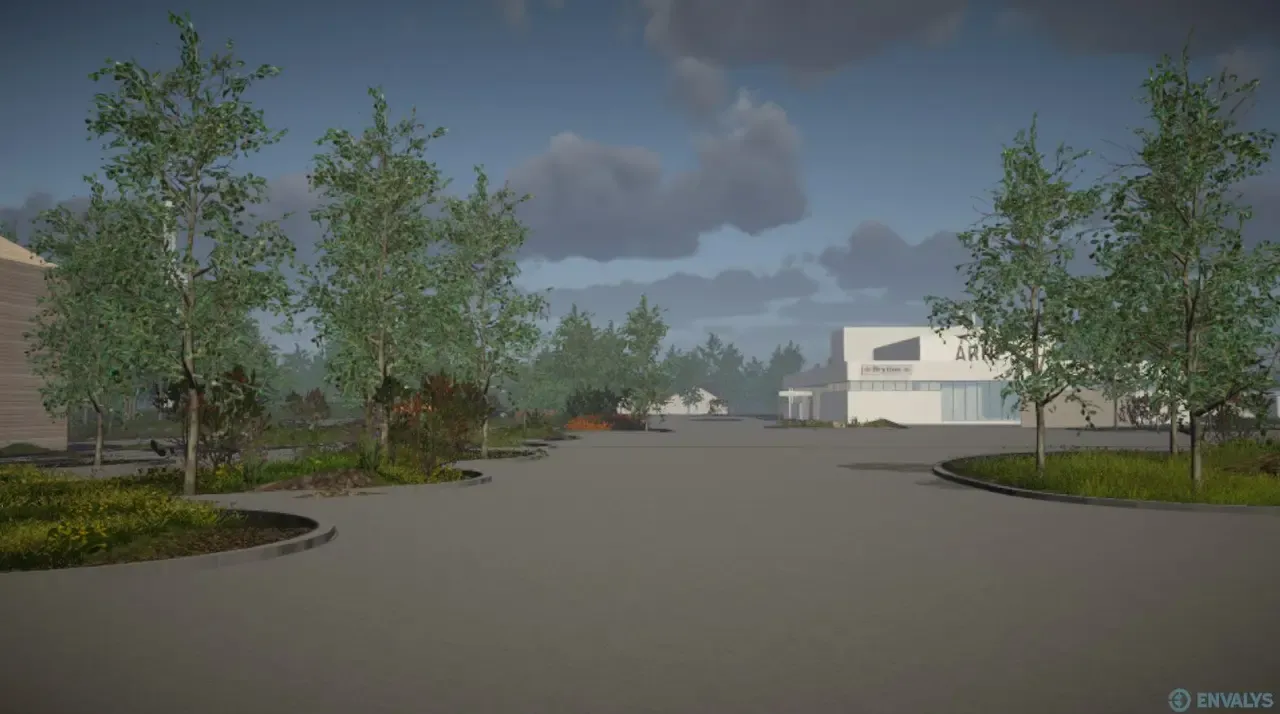
The viewers run in Unity, in the browser — the whole point is that a resident clicks a link and is standing in their town, so a download or a headset would defeat the purpose. That constraint shapes everything:
- Dynamic resource streaming. A whole town doesn’t fit in a browser tab’s memory budget. I implemented streaming so geometry and textures load around the visitor as they move — and, critically, so proposed modifications can be swapped in and out live, letting a meeting compare today’s street with tomorrow’s proposal in real time.
- Optimization for the web. Draw-call budgets, texture compression, and loading behavior all tuned for WebGL running on ordinary home computers — the audience is the public, not gamers with GPUs.
- WebGPU R&D. WebGL’s browser limits became a bottleneck as the town environments grew. I investigated WebGPU as a path toward streaming and rendering substantially larger environments in the browser. This was R&D, not a claim that the public viewers were deployed with WebGPU.
- Infrastructure. I migrated the hosting from AWS to DigitalOcean, keeping the deployment reliable while cutting its running costs — these tools stay online for months while a planning process unfolds.
Why it matters
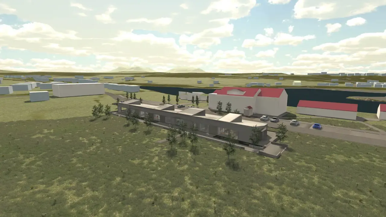
This is simulation in civic service: the same real-time 3D craft that ships games, pointed at the question “what will my street look like?”. The towns’ residents used these replicas to see planned buildings in context — scale, sightlines, character — and give planners feedback grounded in experience rather than blueprints.
Renders © Envalys ehf.
Want something built like this? I'm available for contract work.